CHCNav I90+ Pro

$10,120.00

The I90+ Pro high-performance GNSS receiver combines a built-in GNSS-IMU with RTK positioning capabilities, allowing for L-Band satellite correction signals and subsequently superior GPS accuracy for geospatial data collection and real-time tracking.

VisaMasterCard
ENQUIRE ABOUT THIS PRODUCT FIND A DEALER NEAR YOU

LEADERS IN AGRICULTURAL TECH

40 YEARS EXP

AUSSIE OWNED

FULLY INSURED

TECH SUPPORT

PRODUCT HIGHLIGHTS

  • Instantly ready with simple pole movements; no calibration required.
  • Includes Bluetooth, Wi-Fi, NFC, 4G, and UHF radio.
  • Automatic pole-tilt compensation boosts survey speed by 30%.
  • Supports L-Band and RTX™ for reliable positioning everywhere.
  • Uses 336-channel GNSS for unmatched accuracy and coverage.
Category:

Description

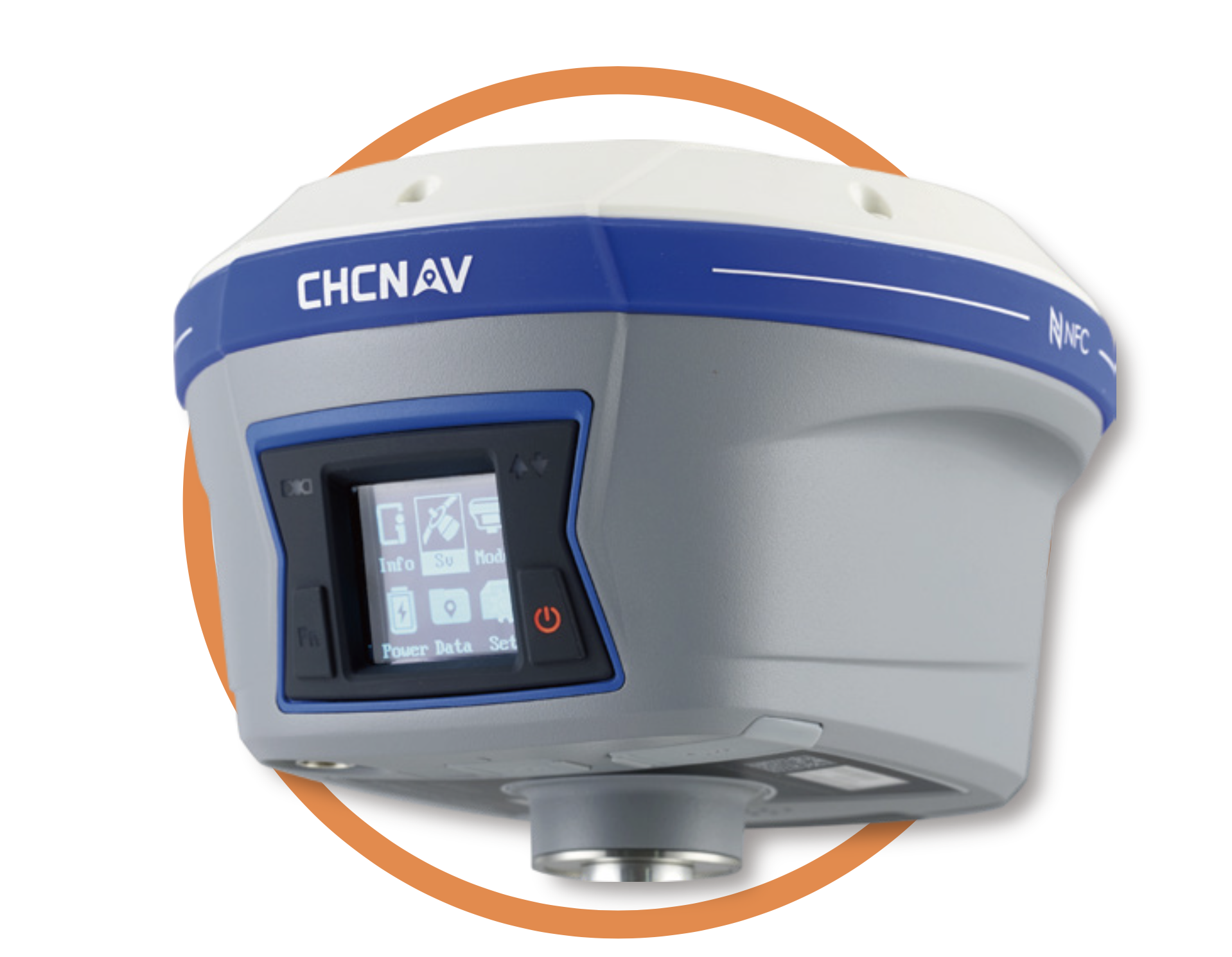
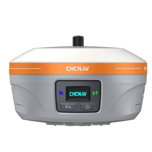
CHCNAV I90+ Pro IMU-RTK GNSS Receiver is engineered for excellence in surveying and engineering applications. This fully integrated GNSS receiver significantly enhances RTK availability without the need for complex calibration, making it ideal for field operations and environments where traditional methods are impractical. As a high-performance receiver that integrates leading-edge technology for precise and reliable geographical data collection, the CHCNav i90+ Pro sets a new benchmark for surveying equipment.


CHCNav i90+ Pro Key Features


  • High-Performance Receiver – the CHCNav i90+ Pro incorporates IMU-RTK GNSS technology to enable real-time surveying without the need for calibration processes, rotations, levelling, or additional accessories.


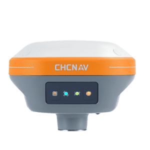
  • Universal GNSS Compatibility – the CHCNav i90+ Pro provides 336-channel GNSS capabilities that uses corrections from all GPS, GLONASS, Galileo and BeiDou signals.


  • Compatible with L-Band & RTXTM Correction Signals – by connecting to L-Band satellite correction signals, the CHCNav i90+ Pro provides accurate, sub-decimeter positioning in virtually all regions where RTK networks, GSM coverage or traditional GNSS base station are not  available.


  • Extended Connectivity – the CHCNav i90+ Pro features Bluetooth, Wi-Fi, NFC, 4G, and UHF radio modem, providing multiple options for data transfer and ensuring robust long-distance communication capabilities.


  • Efficiency Boost – the CHCNav i90+ Pro offers a 30% increase in survey and stakeout speed due to its automatic pole-tilt compensation which operates with a 3 cm accuracy within a 30-degree tilt range.


  • Lightweight Design – weighing just 1.26 kg, the CHCNav i90+ Pro GNSS Receiver features a unique lightweight design to ensure easy transportability in the field.


  • Rugged Construction – the CHCNav i90+ Pro provides an IP67 water and dust rating, with shock protection that allows the receiver to survive a 2-metre pole drop.


Learn more about the CHCNav i90+ Pro in our detailed product overview.


CHCNav i90+ Pro Key Benefits


  • Operational Efficiency – the CHCNav i90+ Pro enhances productivity in the field with quick setup and high-speed data acquisition capabilities.


  • Versatility – with 336 GNSS channels and compatibility with multiple correction signals, the CHCNav i90+ Pro can be used in virtually all regions regardless of RTK network or GSM coverage availability.


  • Durability & Reliability – the rugged design and IP67 rating of the CHCNav i90+ Pro allows it to perform reliably in harsh environmental conditions, ensuring long-term usability and minimal downtime.


  • Extensive Connectivity Options – WiFi/Bluetooth connectivity, 32GB internal storage, and an integrated USB-C data download ensures that positioning data is easily accessible by users of the CHCNav i90+ Pro, whether you’re in the field or the office.


CHCNav i90+ Pro Product Specifications


  • Positioning Accuracy – Horizontal: 8 mm + 1 ppm RMS ; Vertical: 15 mm + 1 ppm RMS


  • Initialisation – Initialisation time: < 10 ; Initialisation reliability: > 99.9%


  • GNSS Channels – Utilises 336 channels.


  • Tilt Sensor – Calibration-free IMU for pole-tilt compensation with bubble levelling, immune to magnetic disturbances.


  • Satellite Systems Supported – GPS, GLONASS, Galileo, BeiDou, and additional L-Band and RTX correction signals.


  • Positioning Accuracy – Offers real-time kinematics (RTK) with horizontal accuracy of 8 mm + 1 ppm RMS and vertical accuracy of 15 mm + 1 ppm RMS.


  • Environmental Resilience – IP67 waterproof/dustproof rating, capable of surviving a 2-metre drop on a pole.


  • Dimensions & Weight – 159 mm x 150 mm x 110 mm, weighs 1.26 kg.


  • Connectivity – 4G modem, WiFi 802.11 b/g/n, Bluetooth v4.1, 1 x USB Type-C port (data download, firmware update)1 x UHF antenna port (TNC female).


  • Internal Memory – 32 GB data storage.


  • Operating Time (Internal Battery) – UHF receive/transmit (0.5 W): 5 h to 8 h ; Cellular receive only: up to 9 h ; Static: up to 10 h.


Key Applications of the CHCNav i90+ Pro


By utilising GPS, Glonass, Galileo and BeiDou constellations as well as L-Band and RTXTM

correction signals for superior accuracy, the CHCNav i90+ Pro is suitable for a wide range of applications, including land surveying and construction surveying.


  • Land & Construction Surveying – the CHCNav i90+ Pro is ideal for environments where precise positioning is critical and traditional GNSS base stations are unavailable.


  • High Mobility Projects – the lightweight, transportable design and superior connectivity of the CHCNav i90+ Pro makes this integrated GNSS receiver suitable for projects requiring extensive movement due to its robust connectivity and high accuracy in challenging environments.


CHCNav i90+ Pro Installation & Setup

Your CNCNav i90+ Pro comes packaged with all the components required for an easy and independent installation.


Here’s our detailed setup guide that shows just how easy the installation process is for your CHCNav i90+ Pro Receiver.


current location

All Locations

Reviews

There are no reviews yet.

Be the first to review “CHCNav I90+ Pro”

Your email address will not be published. Required fields are marked *