Description
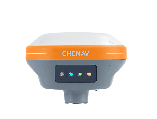
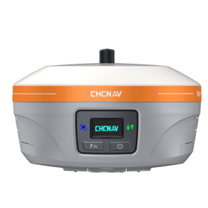
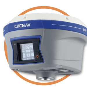
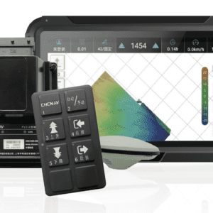
A compact GNSS receiver that supports high-precision positioning, the CHCNav i73+ marks the next step in RTK positioning and base station technology. With built-in IMU-RTK technology to support satellite tracking and GPS accuracy at tilts of up to 30 degrees, the CHCNav i73+ is a versatile piece of surveying equipment that sets a new standard in GIS data collection.
CHCNav i73+ Key Features
- Compact & Lightweight – weighing only 0.73 kg, the CHCNav i73+ is hyper-portable, allowing for easy transportation and operation in the field.
- Survey-Grade Accuracy – using iStar technology, the CHCNav i73+ achieves survey-grade, fixed RTK centimetre positioning within just 30 seconds after power-up, making it suitable for surveying applications.
- Integrated UHF Modem – the CHCNav i73+’s built-in UHF Tx/Rx modem allows the uni to be used as both a base station and a rover.
- Advanced GNSS Tracking – the CHCNav i73+ utilises 1408 channels to optimally track signals from all 5 GPS, GLONASS, Galileo, QZSS, and BeiDou constellations to provide superior RTK positioning accuracy.
- IMU-RTK Technology – using industry-leading IMU-RTK technology, the CHCNav i73+ provides 3 cm accuracy with pole tilt compensation up to 30 degrees, improving efficiency and safety in measurements.
- Rugged Design – the durable magnesium alloy construction and IP67 dust and waterproof rating of the CHCNav i73+ allows it to perform optimally in even the harshest environments and weather conditions.
Want more information? Find our full CHCNav i73+ product overview here.
Benefits: Why Invest in the CHCNav i73+?
- Improved Surveying Efficiency – the automatic pole tilt compensation and fast initialisation of the CHCNav i73+ improve the efficiency of point measurements and stakeout surveys by up to 30%.
- Designed for Ease of Use – the CHCNav i73+’s compact and lightweight design aids in supporting unit transportation and reducing operator fatigue, while the intuitive interface simplifies field operations.
- Reliability – the robust magnesium alloy design and IP67 rating of the CHCNav i73+ ensures durability and performance in harsh environments, reducing downtime and maintenance needs.
- Flexibility – as the CHCNav i73+ can be used as both a base station and a rover, this transformational surveying equipment can be adapted to various jobsite configurations faster and with fewer accessories.
CHCNav i73+ Product Specifications
- GNSS Performance
- Horizontal RTK: 8 mm + 1 ppm RMS
- Vertical RTK: 15 mm + 1 ppm RMS
- Initialization time: <10 seconds
- Initialization reliability: >99.9%
- Connectivity
- Wi-Fi 802.11 b/g/n
- Bluetooth V4.2
- 1 x USB Type-C port
- 1 x UHF antenna port
- UHF Radio
- Frequency: 410-470 MHz
- Transmit Power: 0.5 W, 1 W
- Range: Up to 8 km under optimal conditions
- Memory and Data Formats
- 8 GB internal memory
- RTCM 2.x, RTCM 3.x, CMR input/output, HCN, HRC, RINEX 2.11, 3.02, NMEA 0183 output
- Battery Life
- RTK Rover: Up to 24 hours
- UHF RTK Base: Up to 10.5 hours
- Static: Up to 25 hours
- Environmental Specifications
- Operating Temperature: -40°C to +65°C
- Storage Temperature: -40°C to +85°C
- IP67 waterproof and dustproof rating
CHCNav i73+ Key Applications
As a compact GNSS receiver that’s capable of providing survey-grade accuracy, the CHCNav i73+ is suitable for a wide range of industrial applications, ranging from land surveying and mapping to precision agriculture operations. The adaptability of the CHCNav i73+ UHF modem and its ability to be used as either a base or a rover also allows for improved versatility across various applications.
- Surveying & Mapping – with compatibility to all GNSS satellite constellations, the CHCNav i73+ is ideal for land surveying, topographic mapping, and construction site surveys that include detailed terrain data.
- Engineering – the CHCNav i73+ is useful in various engineering projects requiring precise geospatial data collection.
- Construction Surveying – the CHCNav i73+’s superior IMU-RTK technology enhances accuracy and efficiency in construction site layout and monitoring.
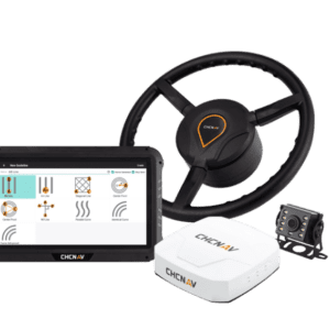
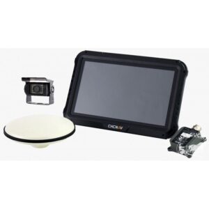
- Precision Agriculture – by providing real-time geospatial data collection capabilities with centimetre accuracy, the CHCNav i73+ supports precision agriculture applications for improved farm management and productivity.
Reviews
There are no reviews yet.