Description
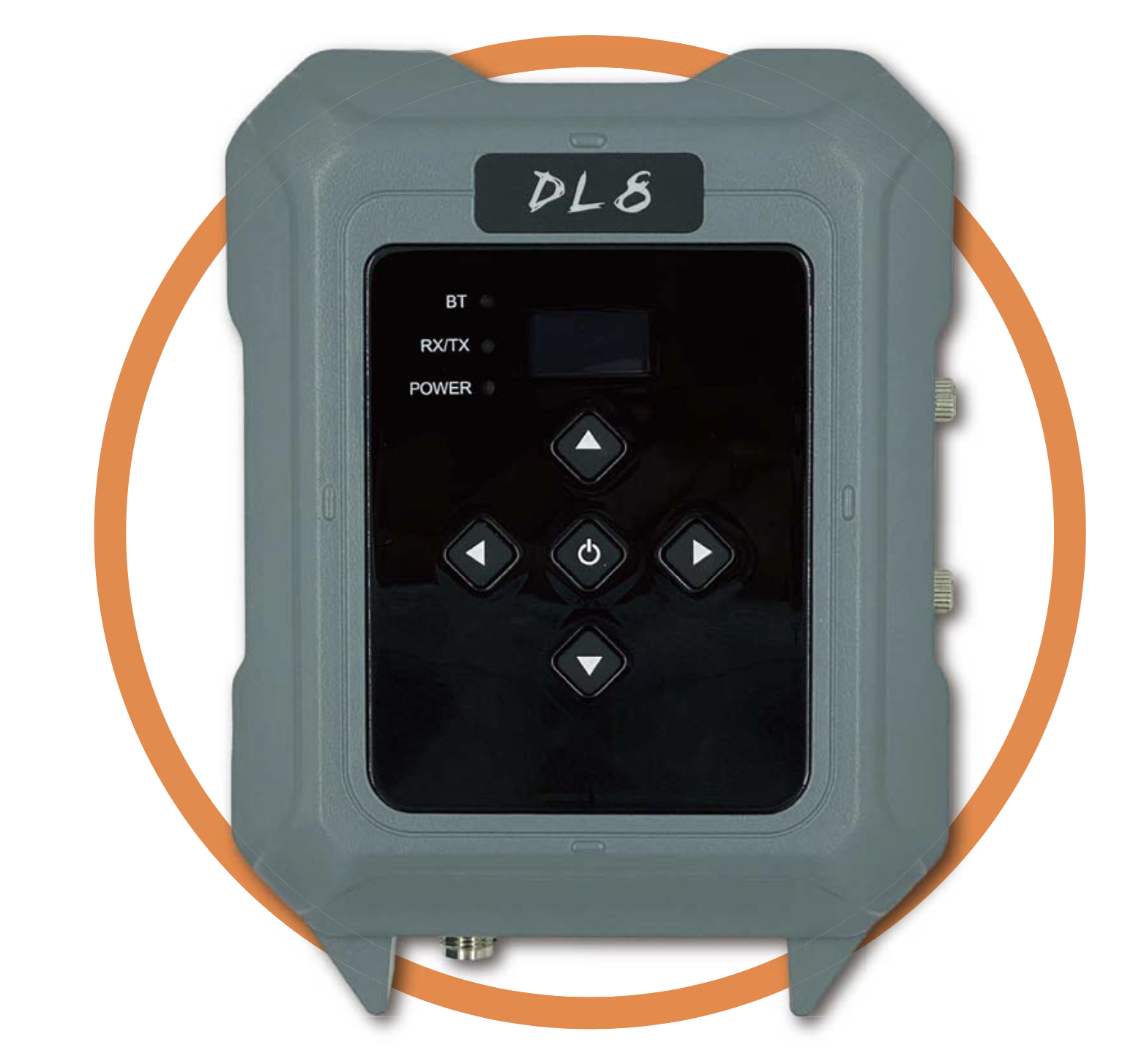
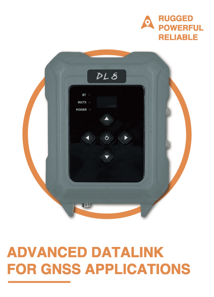
CHCNAV’s DL8 GNSS RTK UHF Radio Modem offers an advanced, rugged solution for GNSS RTK applications, ensuring dependable long-range connectivity even in harsh environments. This rugged UHF radio modem is designed based on extensive fieldwork and CHCNav’s technical expertise, making it a critical data link asset for land surveying, engineering, and other field applications.
CHCNav DL8 Key Features
- High-power UHF Data Link – a rugged, high-performance data link, the CHCNav DL8 is suitable for GNSS RTK applications, ensuring reliable base-to-rover corrections over long distances.
- Configured for a Full 70 MHz Frequency – the CHCNav DL8 operates over a full 70 MHz frequency range, allowing versatile deployment across different geographic areas.
- Six Adjustable Power Levels – the CHCNav DL8 supports six different power levels adjustable from 5 W to 35 W, accommodating various environmental constraints.
- Intuitive Channel Spacing – the CHCNav DL8 allows for channel spacing selectable at 12.5 kHz or 25 kHz, enabling flexibility in signal clarity and range.
- Supports Industry-Standard UHF Protocols – by adhering to industry-standard UHF protocols, the CHCNav DL8 ensures compatibility with a variety of other industry-grade GNSS equipment.
- IP67 Rating – the all-weather, water and dustproof rugged IP67 rating of the CHCNav DL8 makes it suitable for operation in harsh environmental conditions.
Want to know more? Read through the CHCNav DL8 full product overview.
CHCNav DL8 Key Benefits
The device’s flexibility in power and frequency settings allows users to optimise operations for specific project needs and environmental conditions, thereby enhancing field productivity.
The rugged design and all-weather capability ensure that the device can withstand and operate effectively in adverse environmental conditions .
Key Applications of CHCNav DL8
Designed with land surveyors and engineers in mind, the CHCNav DL8 can be used to support any long-range GNSS applications that require or can benefit from robust and reliable UHF communications.
- Land Surveying – the CHCNav DL8 GNSS RTK UHF Radio Modem supports accurate, real-time geospatial data collection for various land surveying tasks.
- Construction Surveying – alongside being suitable for land surveying, the CHCNav DL8’s superior connectivity and full 70 MHz frequency range makes it suitable for use across large-scale construction and development sites.
- Mapping & GIS – a high-power data link with reliable connectivity, the CHCNav DL8 supports GNSS RTK geospatial data collection in even harsh environments and remote locations.
- Agricultural Operations – the CHCNav DL8’s rugged design makes it suitable for field work across a range of industrial precision agricultural operations.
CHCNav DL8 Product Specifications
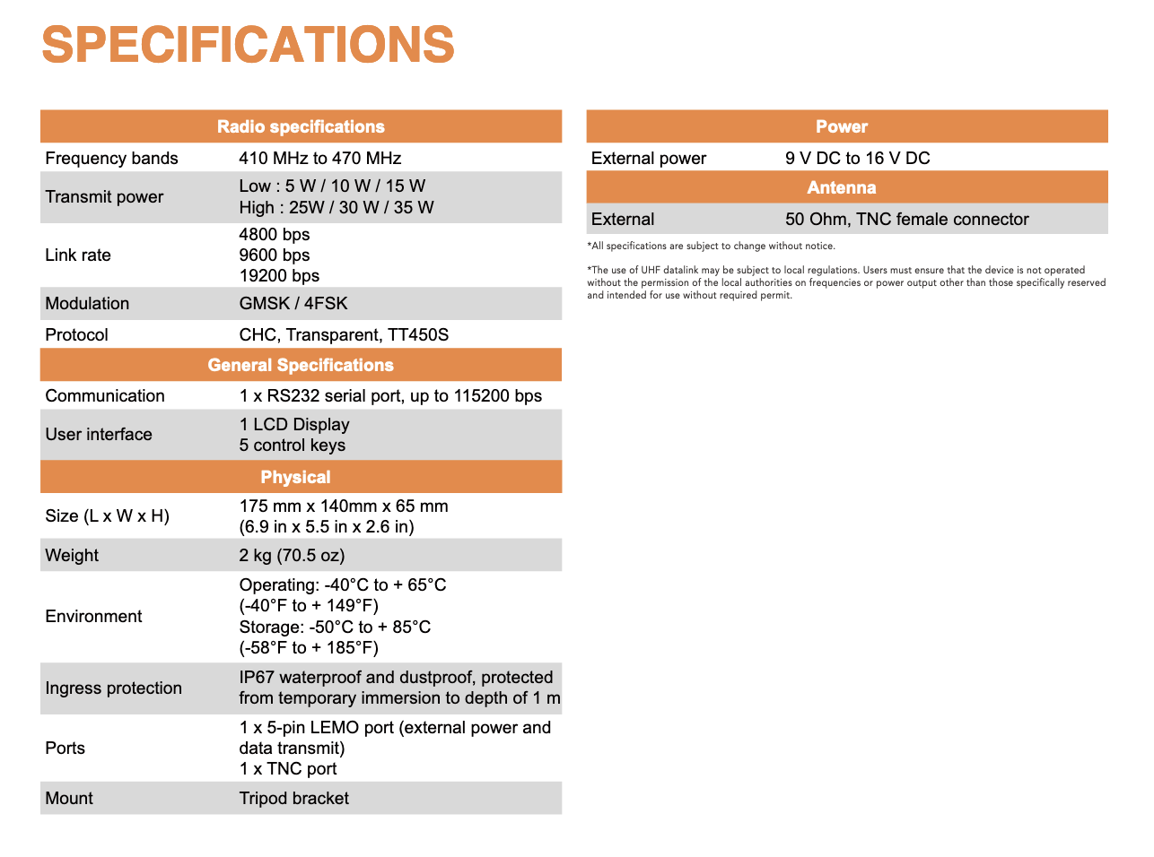
- Frequency Bands: 410 MHz to 470 MHz, offering a broad range for different operational needs.
- Communication: Includes a 1 x RS232 serial port capable of up to 115200 bps for data transfer.
- Modulation Techniques: GMSK / 4FSK, providing efficient use of bandwidth and power.
- Weight: 2 kg, ensuring portability without sacrificing robustness.
- Physical Size: 175 mm x 140 mm x 65 mm, compact enough for easy setup and deployment.
- Environmental Operating Conditions: -40°C to +65°C, suitable for extreme weather operations.
- Power Options: Supports low power settings (5 W / 10 W / 15 W) and high power settings (25 W / 30 W / 35 W) for enhanced range and signal penetration.
Reviews
There are no reviews yet.