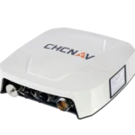
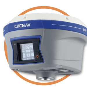
The NX510 SE advanced automated steering system uses all available GNSS constellations and an inbuilt radio receiver paired with an RTK base station to provide low-cost correction signals with a sub-2.5cm accuracy.
Using all available GNSS constellations and an inbuilt radio receiver paired with an RTK base station to provide low-cost correction signals with a sub-2.5cm accuracy, the CHCNav NX510 SE RTK auto-steering system allows farmers to generate higher yields with less resource consumption and greater overall efficiency.
CHCNav NX510 SE Key Features
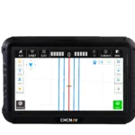
Automated Steering System – the CHCNav NX510 SE’s AgNav software supports a variety of guidance patterns including straight AB line, A+ line, pivots, irregular curves, and headland turns.
High Accuracy – using integrated GNSS+INS terrain compensation technology, the CHCNav NX510 SE ensures hands-free driving with a sub 2.5cm accuracy.
Enhanced Connectivity – the CHCNav NX510 SE utilises built-in connectivity modules like a 4G modem, UHF radio modem, multiple CAN ports, serial ports, and Bluetooth 4.1, to help you stay connected during field work.
Universal GNSS Satellite Constellation Compatibility – the CHCNav NX510 SE is powered by multiple correction sources for superior accuracy, drawing on geospatial data from all 5 GNSS satellite constellations: GPS, GLONASS, Galileo, Beidou, QZSS.
Rugged Design – dust and waterproof components (IP65 rating) make the CHCNav NX510 SE suitable for even the harshest agricultural environments.
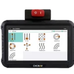
User-Friendly Interface – the CHCNav NX510 SE’s AgNav software on a 10.1-inch industrial display supports multiple guideline patterns and enhances user experience, allowing for ease of use and a minimal learning curve.
Quick Installation – the CHCNav NX510 SE can be fully installed in less than 40 minutes on most farming vehicles, minimising downtime.
With a built-in GNSS receiver for communication with multiple satellite correction sources and RTK receiver for real-time kinematic positioning, the CHCNav NX510 SE boasts 2.5cm pass-to-pass accuracy. Roll and yaw terrain compensation technology further supports the superior accuracy of the CHCNav NX510 SE steering system, making them a vital investment in precision agricultural operations.
Productivity Gains – the CHCNav NX510 SE is designed to increase efficiency and reduce operator fatigue with hands-free driving.
All-Weather Operation – with its IP65 rating, the CHCNav NX510 SE can work in adverse weather conditions, including low visibility conditions.
Flexibility – the CHCNav NX510 SE is easily transferable between vehicles, offering unmatched operational flexibility.
Cost-Effective – provides advanced features at an affordable price, ensuring value for money.
Reliability – rugged design and high-torque steering ensure reliable performance in demanding conditions.
User Experience – the intuitive software interface simplifies operation, improving overall user experience and task accuracy.
Key Applications of CHCNav NX510 SE
The CHCNav NX510 SE advanced automated steering system uses high-precision GPS technology that makes it suitable for a wide range of applications, including land surveying and construction surveying alongside precision agriculture.
Precision Agriculture – the CHCNav NX510 SE is ideal for various harvesting applications, including designing crop patterns and optimising crop rotations to boost harvest yields.
Land Surveying – the CHCNav NX510 SE’s built-in GNSS and RTK receivers provide accurate geospatial data collection for various land surveying tasks.
Construction Surveying – suitable for construction site layout and machine control.
Mapping and GIS – enhances the accuracy of mapping and Geographic Information Systems (GIS) projects.
Agricultural Operations – used in various farming operations to improve efficiency and productivity.
CHCNav NX510 SE Installation & Setup
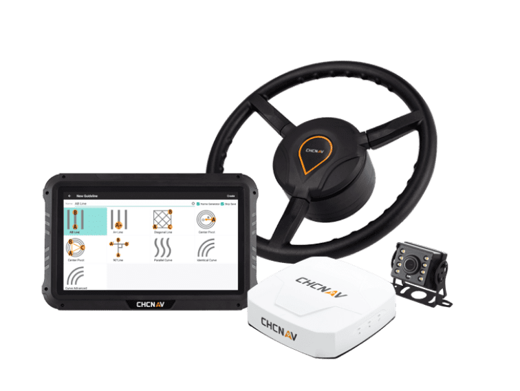
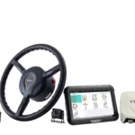
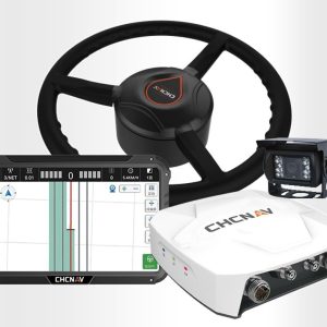
Your CNCNav NX510 SE comes packaged with all the components required for an easy and independent installation.
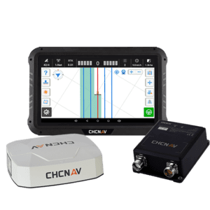
Here’s all the hardware and cabling included in the box with your CHCNav NX510 SE:
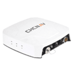
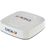
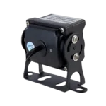
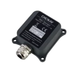
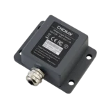
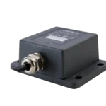
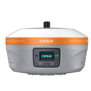
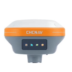
1 x GNSS Receiver
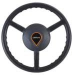
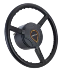
1 x Electric Steering Wheel
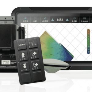
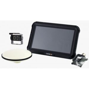
1 x Tablet
1 x Wheel Angle Sensor + cable
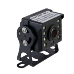
1 x Rear Camera + cable
2 x Ball Base Holders
1 x Double Socket Arm
1 x Standard Bracket
1 x T-Bracket
1 x T Mount Kit (Parts A & B as marked)
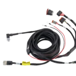
1 x Integrated Main Cable
1 x Radio Antenna
Installing your CHCNav NX510 SE can be done in just under 40 minutes using the step-by-step guide in our user manual.
Step 1: Steering system inspection
Begin by assessing your vehicle’s existing steering system. Check whether the vehicle steering gear is normal, and whether the dead zone (steering clearance) is optimal for CHCNav NX510 SE system installation.
Dead Zone
Action
< 20°
Available range
20° < Dead zone < 70°
Available to install NX510 SE but necessary to modify the dead zone to 10~30 degrees
> 70°
Repair the vehicle before installing NX510 SE
Step 2: Original steering wheel removal
If steering clearance is optimal, remove the vehicle’s original steering wheel and spline screws. Use a high-quality puller tool to avoid damage to the original steering wheel and shaft.
Step 3: CHCNav NX510 SE steering wheel installation
Use the T-bracket and T mount kit or standard bracket to install your new CHCNav NX510 SE electrical steering wheel. Position and tighten spline screws to secure your new bracket and steering wheel.
Step 4: GNSS receiver installation
Wipe your vehicle roof clean before and after installation. Your GNSS receiver should be positioned as close to the central axis of the vehicle roof as possible. The installation direction should also be parallel to the vehicle. Adjust the receiver bracket to make sure the receiver is placed horizontally; the receiver arrow must also face forward.
Step 5: Tablet setup and installation
Your tablet can be installed using the ball base holders positioned either on the vehicle body with dovetail screws, or secured to the tubular section of the vehicle with U-bolts. Both positions allow for optimal ease of access.
Step 6: Wheel angle sensor installation
Fix the wheel angle sensor as horizontal as possible on the right steering wheel to better avoid vehicle collisions.
Step 7: Camera installation
Install the rear camera anywhere on your vehicle that provides an optimal viewing angle and is in range of the wire harness cable length.
Step 8: Cable connections
Follow the detailed cable connection instructions in your CHCNav NX510 SE’s user manual to safely and securely optimise your unit’s cabling.
Step 9: Radio antenna installation
The installation of the radio antenna is not mandatory; it’s only required when customers are using the NX510’s built-in radio mode. Typically, we recommend to install the radio antenna on the vehicle’s roof for better reception of base station signals.
Step 10: External Rx radio installation
For the NX510PRO and NX510PLUS models, which do not include a built-in radio, it’s necessary for users to connect an external ER-2 Rx radio to receive data from the base station if they’re looking to use the unit’s internal radio mode.
Upon installing all components of your CHCNav NX510 SE, perform a test steer run to determine if all hardware is responsive and operating correctly.
CHCNav NX510 SE Product Specifications
Positioning Accuracy: Horizontal: 8 mm + 1 ppm RMS, Vertical: 15 mm + 1 ppm RMS.
Initialisation Time: < 10 seconds.
Initialisation Reliability: > 99.9%.
Display: 10.1-inch touch screen, 281 mm x 181 mm x 42 mm, Android 6.01, IP65 rating.
Connectivity: 4G modem, UHF radio, Bluetooth 4.1, CAN ports, serial ports, NMEA output.
With over 40 years of experience providing tailored agricultural technology solutions to support broadacre farming and other unique industrial applications, Autonomous AG is one of Australia’s most trusted suppliers of farm management software and hardware.
Our partnership with industry-leading manufacturers like CHCNav ensures that Autonomous AG is positioned to provide Australian farmers with cutting edge precision agriculture technologies.
If you’re looking to leverage the power of autonomous farming for your modern farm, speak with our experts in farming innovation here at Autonomous AG today.
Want more information on the autonomous farming and precision agricultural technologies we offer? Our experts are always here to help. Send an inquiry to our team Autonomous AG to secure the right intelligent farming systems for your needs.


Reviews
There are no reviews yet.